
Castro da Saceda
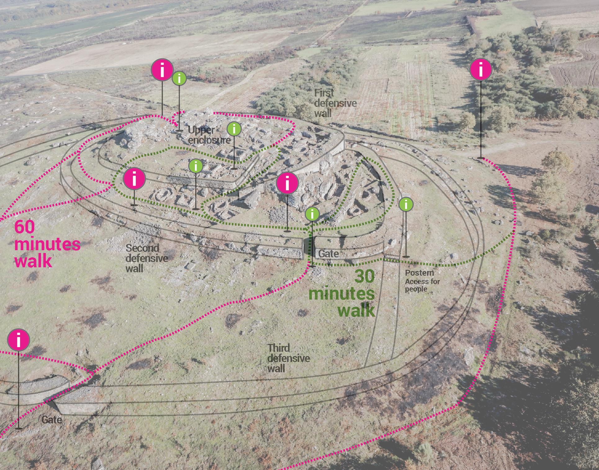
A War HammerThree walled enclosures
The North gate
The South quarter
The postern
A Cyclopean gate
Manufacturing tiles
The first fortified settlement
Pottery
A Cida da Saceda is located on a rocky hill 798 m. in height, in the middle of a wide Portuguese-Galician plain located between the prominent and cold Serra do Larouco (1,398 m) and the warm depression of the River Támega (385 m). This fortified town was built just over 3.5 km northwest of A Cidá de San Millao, and is one of the most monumental and amazing forts of the entire Monterrei district. The settlement of Cida da Saceda is situated in a position that allows it to control and visually dominate the resources of the area: water, farmland, natural roads, mining resources such as tin, etc., all of which were important elements during the Iron Age (800 BC - Year 0). This village fortified in height was occupied between the VI centuries BC and I AD was excavated during the decade of 1980s. In 2011 it was declared as an Asset of Cultural Interest.